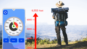
15 Best Altimeter Apps for Android and iOS. Avid hikers and trekkers need altimeters to find out the precise altitude they are currently at. However, an altimeter tool can be costly. If you can’t afford one, transform your smartphone into a digital altimeter with the best altimeter apps.
These applications come in handy to keep track of your position. The good news, some altimeter apps come loaded with features like GPS tracker and compass, so you’ll be unlikely to get lost at the altitude. Take a look at the best app references below.
Best Altimeter Apps for Android and iOS
In this article, you can know about Altimeter Apps here are the details below;
We have put together some altimeter applications designed for Android and iOS devices. Simply pick one or more apps from the following list and make the most of your hiking or trekking.
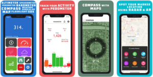
1. GPS Tools
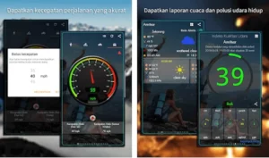
GPS Tools is an all-in-one GPS applications that include altimeter, speedometer, compass, weather & forecasts, and more. With over 5M+ downloads on the Google Play Store alone, this is one of the most used applications among hikers and trekkers.
This app sends you the exact location with high accuracy, though you are in a low signal area. It also lets you share location address, photos, and coordinates with others. Whether you are going camping or trekking, feel free to access the compass and altimeter in this app.
There are tons of features and functionalities to find in GPS Tools. Once you find the altitude or distance at the current place, you can save it for future visits. It also supports Android wear for your convenience.
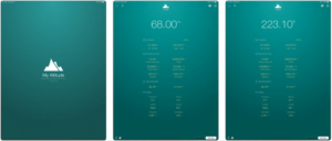
2. Altimeter by EXA Tools
Altimeter is a smart app built to measure altitude. Brought to you by EXA, it is among the best altimeter apps for hiking, trekking, skiing, and outdoor activities. It promises high precision to check elevation, altitude, and localization coordinates both online and offline.
Altimeter app has a number of features, including accurate measurement, smart mini compass, full support of GPS coordinates, and measurement charts. You can also expect localization name and state using an internet connection.
Sharing is caring. If you want to share your experience at altitude, it has a built-in sharing feature. With it, you can share altitude photos or export them to other places.
Altimeter app is designed with an intuitive and user-friendly interface, allowing you to measure altitude effortlessly. For your convenience, it also provides inverted background color that can be chosen as desired.
3. Accurate Altimeter
Here’s Accurate Altimeter, one of the most downloaded altimeter apps on Google Play Store. Working with and without internet connection, you can expect a lot of things from this tool from accurate measurement to historical charts.
Accurate Altimeter measures altitude in 3 ways: using satellite triangulation that works without internet connection but shows less accurate measurement; using a global elevation map and take the elevation at current position; and use pressure sensor for improved accuracy.
This particular app is free to download. If you want to enjoy additional features, you’ll need to upgrade to the Pro version. Once upgraded, you can download a larger area of global elevation, record altitude without accessing the app, and choose elevation without limitation on the map.
4. DS Altimeter
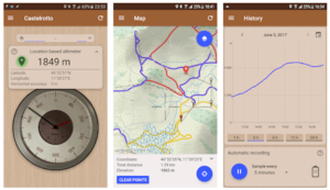
Introducing DS Altimeter, an altitude meter app designed to help you measure elevation and altitude. Not only does it show and track your altitude, but it also searches the altitude for other locations. All you have to accomplish is select the best source of data and get the information.
DS Altimeter has four main highlights, including altitude search, multiple altitude sources, altitude tracker, and altitude widget. When it comes to elevation data source, you can choose between four options like satellite-based altitude or land survey altitude.
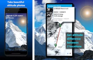
New features have been added to DS Altimeter. The latest version comes packed with photo altimeter to snap a picture, altitude difference between two locations from the map, and altitude profile record. Not to mention you can view your altitude recordings on the map.
5. Altimeter by Pixel Prose SARL
Are you looking to measure altitude with a handy tool? If your answer is yes, this altimeter app is surely for you. This simple app lets you get accurate altitude at your current location. It accesses your device location from the GPS signal, thus it can provide you with current altitude and elevation.
In addition to true altitude measurement, it highlights offline mode that allows you to use the app even if you’re out of range. You can also select either GPS satellite or barometer and easily pick a location on map. For easier search, simply submit the name or address you want to measure.
This best free altimeter app has an attractive and intuitive design. Made for Android devices, it can be the perfect tool for outdoor activities like skiing, hiking, or mountaineering.
6. Smart Altimeter
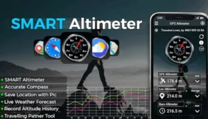
Smart Altimeter is an online and offline tracking app for measuring elevation and altitude. With this app, you can expect accurate measurement in meters or feet. Thanks to a complete set of features, it can be your best partner for outdoor activities.
Among the highlights is altitude history. This app allows you to save altitude history with chart and take a picture of your current location. You can also edit location and measure elevation from the ground level.
This altimeter app comes packed with both GPS map and offline map that provides different modes of terrain, including satellite mode and hybrid. Smart compass and weather forecast are also available to improve your experience.
7. Barometer & Altimeter
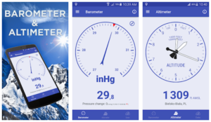
Combining altimeter and barometer, this is a useful and functional tool for measuring altitude and atmospheric pressure. It utilizes built-in GPS, pressure sensor, and automatic calibration algorithm for altitude and atmospheric pressure.
As one of the best altimeter apps, it features accurate height measurement for altitude and barometric pressure. It also provides information and current weather data from the local weather station. Information about outside temperature is also available in this app.
What’s more, Barometer & Altimeter allows you to find a complete set of information like visibility, wind speed, and humidity. Overall, this application has everything you need to improve your outdoor adventure experience.
8. Altimeter App
Be sure to download the Altimeter App before you climb a mountain or hike. This app is built to help you check altitude, elevation, and pressure level from your smartphone. Featuring barometer, it is possible to measure the atmospheric pressure and wind pressure that affect your activity.
Made to be accessible to anyone, Altimeter App is designed with an intuitive, simple, and user-friendly interface. It has two options for altitude meter, including analog and digital meters—you can choose one that suits your preferences.
How this app works is quite simple. It uses GPS system to detect your current location as well as a barometric sensor to figure out the altitude of your location. Whether you are climbing, hiking, or skiing, it promises accurate measurement of height level.
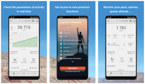
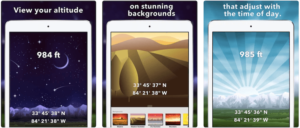
9. My Altitude
Using GPS signals from your smartphone, My Altitude is an accurate altimeter app for anyone. Whether you’re a hiker, tracker, or outdoor activity enthusiast, you will find this app useful to support your activity. Also check Evernote Alternatives
With this app, you can determine your altitude, location, and barometric pressure. It is designed to work offline, which means you can use it without internet connection—of course, it comes in handy for outdoor activities. It also allows you to use NOAA data files to get your location altitude.
What’s interesting about this app is that you can take a picture wherever you are. Feel free to save it in your photo album and enjoy it anytime. Your pictures will be sealed with detailed information including coordinates of current location, local date/time, and also altitude.
10. Travel Altimeter & Elevation
Designed for the iOS-based device, this is a top-rated altimeter app with millions of downloads. It has the ability to measure current elevation and altitude so you view the information for adjusting your activity. It also has a barometer that helps track altitude changes according to pressure change.
This simple and straightforward application comes loaded with features, such as highly accurate GPS, built-in flashlight, and metric options in meters and feet—even it provides detailed information about ground elevation from the topographical map value.
As one of the best altimeter apps, it allows you to easily share with anyone. Feel free to share screenshots of the beautiful location to various social platforms like Instagram, Facebook, and even your email. You can use custom background to take amazing photos from altitude.
11. Commander Compass Go
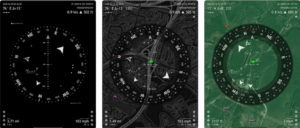
Next on the list, here’s Commander Compass Go that is mainly designed as a powerful offline GPS app for iPhone, iPad and Android. You can find a long list of features in a single app, including gyrocompass, speedometer, altimeter, GPS receiver, and many more.
This app can do a lot of things, from saving your custom places to displaying detailed GPS info. It also lets you measure distance and angle, navigate to saved places and waypoint, and track multiple targets concurrently—even you can track positions of sun, moon, and stars.
Additionally, Commander Compass Go is featured with special compass modes as well as calibration methods that make it more accurate and advanced. As a tracker, it allows you to copy, paste, and share map links or locations using different formats.
12. Altimeter GPS
Trusted by many, Altimeter GPS is among the best altimeter apps for hikers, trekkers, and outdoor sport enthusiasts. This multipurpose application is equipped with various features like barometer, compass, altimeter, pedometer, and even weather updates.
With a complete set of features, you can save hundreds of dollars on expensive tools. All you have to do is download Altimeter GPS on your iPhone or iPad and let your adventure begin.
One of the most unique features in this app is flashlight—it provides bright, reliable, and optimized flashlight for night use. Not to mention it features voice instructions when you mark or unmark location.
13. Altimeter: Elevation, Compass
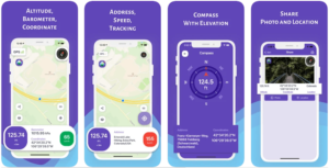
This is a useful app to monitor the altitude, direction, and pressure of your current place. Many people have used it for running, hiking, and trekking, not to mention it allows you to add values to the photos.
Discovering your altitude, location, and geographic coordinate made simple and instant with this altimeter app. You also have an option to take picturesque photos and share with your loved ones. Each photo will include detailed information like address, altitude, and geographic coordinates.
In addition to altimeter, this app comes with compass mode with which you can track current location and direction. It comes in handy to make your travel or outdoor adventure more fun.
14. My Altitude and Elevation GPS
If you are looking for the best altimeter apps for Apple’s iPhone or Apple Watch then this app is made just for you. This simple and modest application provides you with detailed information about elevation and altitude. It also displays latitude and longitude in different formats.
Find dozens of useful features like the ability to share location, customize photos, save photos in history, share coordinates, export-import data. It also provides a simple tutorial on how to use this application, especially for beginners. Also check Figma Alternatives
15. Altimeter+
Altimeter+ app is designed for outdoor sport enthusiasts who spend their time at altitude. Using this tool, you can measure the altitude of your location via GPS, barometer measurement, or Aster. It also offers an average calculation of altitude and an integral map that shows compass and peaks.
When it comes to features, Altimeter+ has much to offer. In addition to barometer altitude measurement, it provides imperial and metric unit measurements. Best of all, it supports offline mode that allows you to measure altitude without internet connection.
If you don’t mind spending a dime, Altimeter+ could be the perfect altimeter app for your adventure. Download on your iOS device and make the most of your activity.
Altimeter apps allow you to measure altitude and elevation using your phone’s GPS signal or barometer sensor. Find the best altimeter apps that help you find out your current location accurately.